
It was exactly 48 years ago when Maryland’s numerical representation in Congress was last adjusted for population growth. The year was 1962, and there was no such thing as redistricting and reapportionment. The “one-man, one-vote” principle had not yet been adjudicated by the Supreme Court and under-populated rural counties dominated the state’s politics because of the “unit rule.” Not knowing what else to do, the ministers of influence in Washington created a “golem,” if you will, an artifice endowed with the properties of a Congressman. It was called a Congressman at-large, kind of a third U.S. Senator without portfolio.
The Congressman at-large who was elected that year was Carlton R. Sickles (D), a state delegate and labor lawyer whose political taproot was in Prince George’s County. Sickles served two terms as a member of Congress who represented the entire state, at-large, with full voting rights. He ran for governor in 1966 in a bitter four-way race and was rolled over by George P. Mahoney (D) by the micro-chip margin of 1800 votes. By the time Sickles ran for governor, the Supreme Court had decided that population determines representation in the House of Representatives and not geography. The old unit rule was overturned and redistricting was born. Maryland’s seven congressional districts were re-jiggered to eight and have remained there ever since.
Fast forward. The Census Bureau has reported the first installment of its decennial body-count. The initial figures show that Maryland’s population has grown by 480,000 to 5.773 million over 10 years, probably a short-count because of the floating homeless population and those who arrived by illicit entry and continue to avoid detection or enrollment. Add to those a new category of invisible people who believe their existence is nobody’s business, especially the prying government’s, who refused to participate in the census. Nearly a half million new inhabitants is a sizeable jump in bodies but not enough for an additional Congressman because other states, especially those with more accommodating climates, grew faster and bigger.
In the 10-year game of legalized bodysnatching called Congressional redistricting, and its local corollary, legislative reapportionment, the size of the House of Representatives remains the same—435 seats—but they are shifted to those states that gained population at the expense of those that lost bodies. The east has lost to the south and west in the recent migration to greater job prospects and lower heating bills and, in some cases, even lower taxes. Those states that will gain seats are: Arizona, Florida, Georgia, Nevada, South Carolina, Texas, Utah and Washington. Those that will lose seats are: Illinois, Iowa, Louisiana, Massachusetts, Michigan, Missouri, New Jersey, New York, Ohio and Pennsylvania. It is impossible to replicate climate although they’re working on it.
So what’s the big deal about an elaborate game of musical chairs where the entire Congress is a moveable feast? At first glance, the shift in representation appears especially daunting for Democrats. Numerical power is departing the Northeast, which tends to be Rust Belt and Democratic, and heading for the South and West, which leans conservative and Republican. Yet many of the new arrivals across the map are immigrants, mainly Hispanic, who favor bread-and-butter allegiance to the Democratic party. What’s more, the mid-term elections greatly diminished the number of state houses under control of Democratic governors to 17, with more than 30 in the hands of Republicans And it’s in the state Houses where redrawing the Congressional and legislative maps will occur.
Representation translates to money. Many federal aid formulas are tied directly to population and determine the flow of billions of dollars to state and local governments. The number of representatives in Congress that a state has directly affects the amount of “pork” and/or “earmarks” that are channeled to a state through localized projects in specific Congressional districts. Maryland is particular beneficiary of federal largesse because of the large number of government, military, research and defense installations, the Chesapeake Bay, the National Institutes of Health, the Social Security Administration and the Johns Hopkins complex, which includes the Applied Physics Lab, which is the second largest recipient of federal research grants in the nation.
>At the more devious political level, redistricting and reapportionment have become an elaborate shell game of legalized gerrymandering in a cozy connivance between legislatures and the courts. It is simply an exercise in screwing the other party moreso than legislating the interests of the people. Gerrymandering is responsible for much of the gridlock and polarization in Washington as well as elsewhere. When the one-man, one-vote order was decreed, certain guidelines where established but have since vanished with a cynical wink from the courts. Geography, contiguity, commonality of interests and population balance were the original prescription for Congressional and legislative mapmaking.
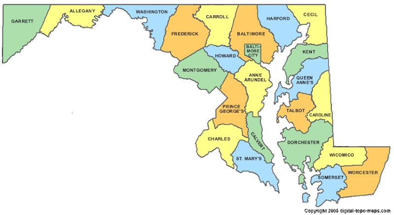
All that remains today is population balance, currently at more or less 650,000 bodies per Congressional District in Maryland. Take Maryland’s First District, for example: What does Cambridge, on the Eastern Shore, have in common with Cockeysville, in Baltimore County? Nothing. But when the current maps were drawn in 2002, Gov. Parris Glendening (D) was trying to tuck it to Rep. Wayne Gilchrest (R) by crossing the Chesapeake Bay where Gilchrest was considered unknown. The effort failed. The same ploy was tried with Rep. Roscoe Bartlett (R) by stretching the Sixth District like an elongated crazy ribbon across the top of the state from Garrett County to Harford County. And the same bag of tricks will be exercised in 2012 when Gov. Martin O’Malley (D) applies his Sharpie to the state’s maps. The shift of a few precincts here, a couple of blocks there, can make or break a political career by removing friendly territory or adding hostile turf.
And across the nation, the direct effect of redistricting will make itself felt when the presidential election reaches its, one hopes, anticlimactic finale in the electoral college which, technically, has the final say on the people’s choice for president. Twice in our history the election of a president was decided by the House of Representatives because a single candidate failed to secure enough electoral votes (270).
Before the one-man, one-vote decree, each senatorial district in Maryland had a state senator. The Eastern Shore’s nine counties each had one senator as did all the other rural counties. They usually voted as a bloc against the interests of the population centers of Baltimore City and the burgeoning urban counties and thereby dominated the state’s politics. Now the reverse is true: Five urban population centers—Baltimore City, Baltimore County, Howard County and Montgomery and Prince George’s Counties eclipse the remaining 19 counties in their vote-pulling power and usually get their way.
And here’s a footnote for historians and hobbyists. The original one-man, one-vote decision by the Supreme Court was provoked by a young female graduate student in Atlanta, GA. She and another student filed the suit as part of their program for doctoral degrees in political science. The suit meandered all the way to the nation’s highest court. They won. She got her doctorate. And she later became the wife of Baltimore City Police Commissioner Donald D. Pomerleau.